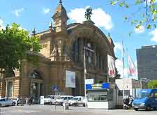
Frankfurt Airport (FRA)
Driving Directions / Travel by Car
(Frankfurt Am Main, Germany)

Located just minutes from the city centre, Frankfurt Airport (FRA) is located on the city's south-western outskirts and can be easily found from most directions, with the A3 / E42 edging its northern perimeter. Also nearby, the A5 / E451 runs in a north / south direction, to the east of Frankfurt Airport, near to Zeppelinheim.
Local areas close to Frankfurt Airport include Eddersheim and Weilbach to the west, and Hattersheim am Main, Kelsterbach and Okriftel to the north-west.
Directions to Frankfurt Airport (FRA) from the north
- From north Germany, take the A5 highway and head towards the city
- Continue along the A5 highway and follow sign posts to Frankfurt Airport, signed 'Flughafen' (before junction Frankfurter Kreuz)
- Frankfurt Airport is well signposted from here
Directions to Frankfurt Airport (FRA) from the south
- From south Germany, take the A67 highway
- Take the A5 and head towards Frankfurt and Frankfurter Kreuz
- Follow sign posts to Frankfurt Airport, signed 'Flughafen'
- Frankfurt Airport is well signposted from here
Directions to Frankfurt Airport (FRA) from the east
- From east Germany, take the A3 and head towards the city
- Passing the junction at Frankfurter Kreuz
- Follow sign posts to Frankfurt Airport, signed 'Flughafen'
- Frankfurt Airport is well signposted from here
Directions to Frankfurt Airport (FRA) from the west
- From west Germany, take the A3 and head towards the city
- At the junction at Wiesbadener Kreuz, take the A66 towards Frankfurt
- Follow sign posts to Frankfurt Airport, signed 'Flughafen'
- Frankfurt Airport is well signposted from here
When driving to Frankfurt Airport (FRA) during rush hours, do bear in mind that the autobahns can become extremely busy.
Frankfurt Airport (FRA): Virtual Google Maps
 Located just minutes from the city centre, Frankfurt Airport (FRA) is located on the city's south-western outskirts and can be easily found from most directions, with the A3 / E42 edging its northern perimeter. Also nearby, the A5 / E451 runs in a north / south direction, to the east of Frankfurt Airport, near to Zeppelinheim.